GGOS and related News
[20100205] 2010 GGOS Retreat took place ...[20091214] GGOS Reception took place ...
[20091205] GGOS 2010 Retreat and 17th GGOS SC meeting ...
[20091124] GGOS Reception at AGU ...
[20091120] GGOS participated in GEO-VI ...
[20091031] OceanObs'09 Community White Papers ...
[20091010] Second IGCP 565 Workshop took place ...
[20090818] GGOS 2020 book published ...
[20090731] Another article on GGOS has been published ...
[20090525] IERS issues CfP for restructured GGFC ...
[20090426] Astrocast TV Feature on GOCE widely noted ...
[20090423] New Astrocast TV Feature series started on Earth Day ...
[20090414] Article on GGOS published in Geosciences ...
[20090331] Second part of Article in Geomatics World published ...
[20090317] ESA’s GOCE launched ...
[20090316] Joint DynaQlim/GGOS Workshop announcement published ...
[20090108] Article on GGOS published in Geomatics World ...
[20081222] GGOS and geodesy monitor sea level ...
[20081219] GGOS Article to appear in Géosciences ...
[20081215] GGOS Steering Committee selected new GGOS components ...
[20081213] First IGCP 565 Workshop took place ...
[20081108] GGOS received proposals for new components ...
[20081107] GGOS Article to appear in Geomatics World ...
[20081013] Deadline for proposals for GGOS components extended ...
[20080915] GGOS SC14 on December 14, 2008 in San Francisco ...
[20080913] First Workshop of the IGCP 565 Project announced ...
[20080715] CfPs for new GGOS Components published ...
[20080326] IGCP 565 Project accepted for funding ...
[20080325] Near-real time minutes of the GGOS Retreat ...
[20080323] V0.18 of the GGOS 2020 book available ...
[20071213] 12th Meeting of the GGOS SC took place ...
[20071130] GGOS Chairs at Ministerial Summit ...
[20071126] Presentations of GEO/GGOS Geohazards Workshop avaialable ...
[20071107] 2007 GEO/GGOS Workshop took place ...
[20070730] Geodetic journey has started ...
[20070715] GGOS elevated to be a full IAG Component ...
[20070421] GGOS 2020 Forum took place at EGU ...
[20070317] GGOS contributes to Preparation of Minsterial Summit ...
[20070302] GGOS 2020 Forum at EGU 2007 announced ...
[20061201] Reference Frame-related Task accepted for the GEO Work Plan ...
[20061016] 2006 GGOS Workshop took place in Munich, Germany ...
[20060929] IAG/GGOS provide comments on the Draft GEO Work Plan ...
[20060924] GGOS 2006 Workshop focuses on the GGOS2020 Process ...
[20060620] Work on the GGOS2020 Document started ...
[20060617] Reference-frame related task proposal submitted to GEO ...
[20060530] GGOS Science Panel established ...
[20060525] Second circular of the 2006 GGOS Workshop available ...
[20060523] GGOS is partner in the IGOS Partnership ...
[20060420] GGOS joins Committee of UNESCO's GARS and IGOS-P ...
[20060418] Fifth Meeting of the GGOS Steering Committee took place ...
[20060404] GGOS Poster presented at the Early Warning Conference III ...
[20060303] Initial GGOS Science Panel established ...
[20060226] Fourth Meeting of the GGOS Steering Committee took place ...
[22 December 2008] GGOS and geodesy monitor sea level: The Newsletter of the Information Zentrum Sydney of the DAAD reported in its Issue 13 of December 2008 on the "Annual Alumni and Scholarship Holder Meeting in November". One of the presentations at this meeting was given by the IAG Vice President Chris Rizos with the title "What Geodesy can tell us about Sea Level Rise". The Newletter reports on page 3 the following about this presentation:
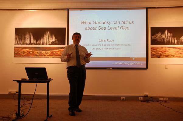
"Chris Rizos: What Geodesy can tell us about Sea Level Rise
Geodesy is the science of measuring and mapping the geometry, orientation and gravity field of the Earth including the associated variations with time. Modern Geodesy involves a range of space and terrestrial technologies that contribute to our knowledge of the solid earth, atmosphere and oceans. These technologies include: Global Positioning System/Global Navigation Satellite Systems (GPS/GNSS), Satellite Laser Ranging (SLR), Very Long Baseline Interferometry (VLBI), Satellite Altimetry, Gravity Mapping Missions such as GRACE, CHAMP & GOCE, satellite-borne Differential Interferometric Synthetic Aperture Radar (DInSAR), Absolute and Relative Gravimetry, Precise Surveying (Levelling & Traversing).
The Global Geodetic Observing System (GGOS) is an important component of the International Association of Geodesy (IAG). GGOS aims to integrate all geodetic observations in order to generate a consistent high quality set of geodetic parameters for monitoring the phenomena and processes within the 'System Earth'. Integration implies the inclusion of all relevant information for parameter estimation, implying the combination of geometric and gravimetric data, and the common estimation of all the necessary parameters representing the solid Earth, the hydrosphere (including oceans, ice-caps, continental water), and the atmosphere.
Chris’ presentation focused on the contribution geodetic space techniques are making to: (a) define the reference frame, (b) measure global sea level rise using Satellite Altimetry, (c) monitor the stability of tide gauges that measure the local differential change in sea-land level, (d) separating the sea level rise from thermal expansion from that of ice melt effects (which change the gravity field), and (e) making accurate determinations of coastal Digital Elevation Models for coastal zone vulnerability studies.
Humboldt alumnus Professor Chris Rizos holds a Doctor of Philosophy in Satellite Geodesy and is Head of the School of Surveying & Spatial Information Systems at UNSW as well as the Vice President of the above mentioned IAG."