Introduction
The two meanings of GGOS
The science rationale for GGOS
GGOS: The Organization
Current structure of GGOS ...
Future structure of GGOS ...
Links and relations of GGOS ...
GGOS: The System
The three pillars ...
The challenges ...
The GGOS Infrastructure
Contributing infrastructure ...
Levels of infrastructure ...
GGOS: The Applications
Mass Transport
GGOS and Geohazards
The Global Geodetic Observing System
GGOS: An Observing System of Layered Infrastructure
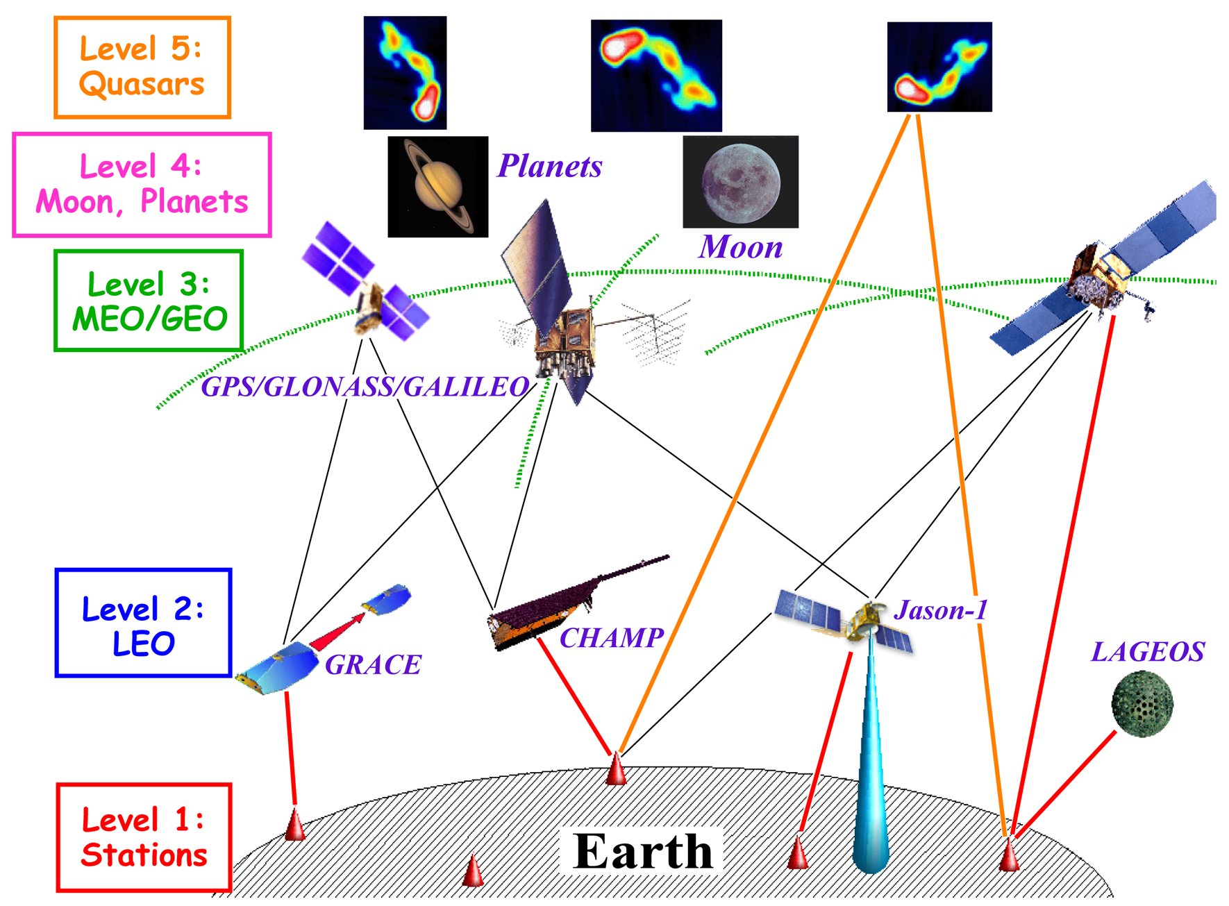 |
The five levels of GGOS and their interactions with observations of various types. The infrastructure of GGOS consists of five distinct levels, depending on the distance to the Earth' surface. Level 1 at the Earth's surface consists of the ground networks of in situ instruments and space-geodetic tracking stations, as well as the data and analysis centers. Level 2 are the LEO satellites, for which highly accurate orbits are determined with the help of the ground-based level as well as Level 3, that is, the GNSS. The ground networks and the GNSS are crucial in positioning. Level 4 comprises the Moon and the planets and this level is particularly important for the dynamical reference frame. Finally, Level 5, are the stable quasars, which provide the inertial reference frame fixed in space. |
The contributing infrastructure ...
In case of problems, mail to info@iag-ggos.org.