Introduction
The two meanings of GGOS
The science rationale for GGOS
GGOS: The Organization
Current structure of GGOS ...
Future structure of GGOS ...
Links and relations of GGOS ...
GGOS: The System
The three pillars ...
The challenges ...
The GGOS Infrastructure
Contributing infrastructure ...
Levels of infrastructure ...
GGOS: The Applications
Mass Transport
GGOS and Geohazards
The Global Geodetic Observing System
GGOS: An Observing System of Layered Infrastructure
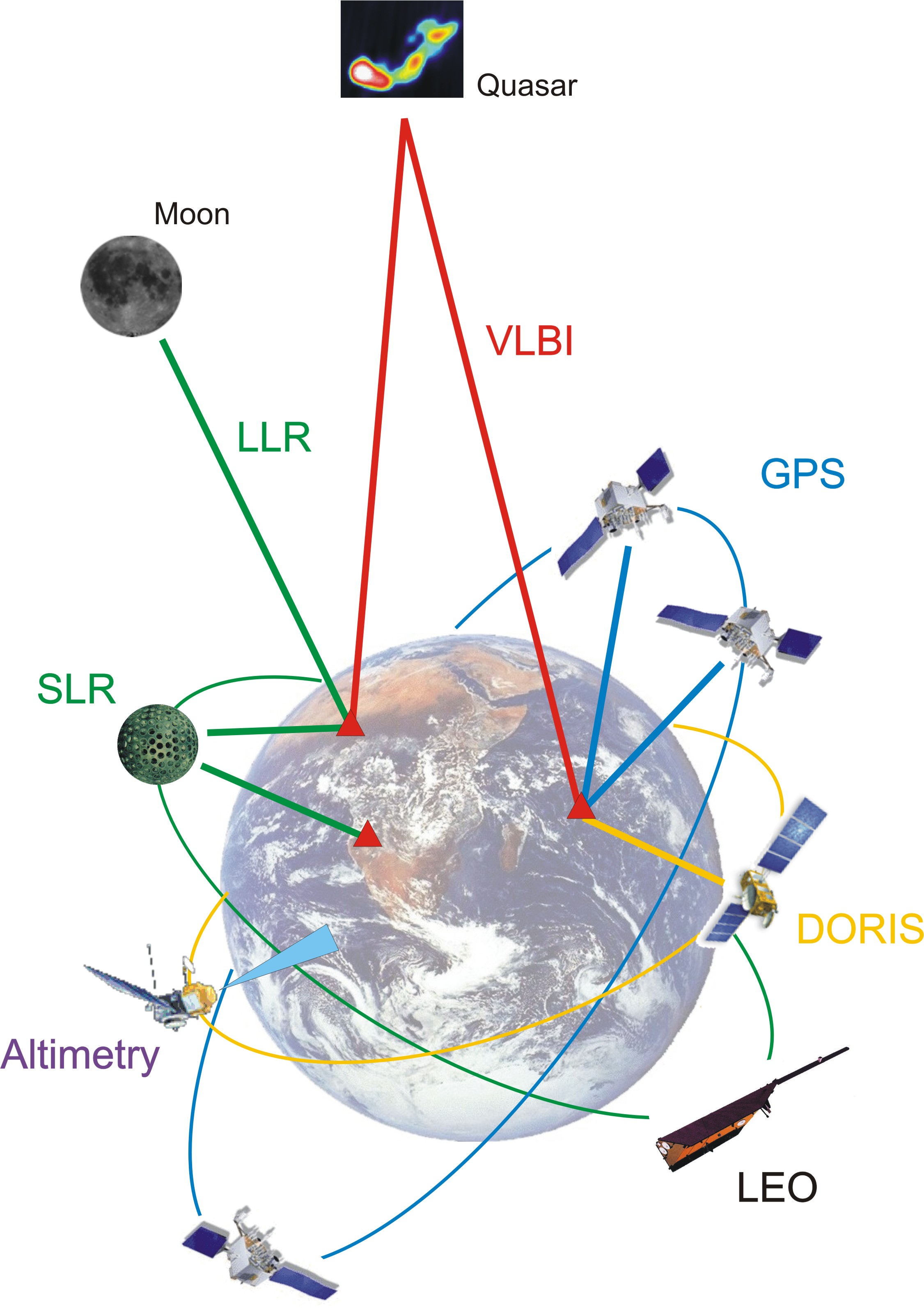 |
Infrastructure contributing to GGOS. The combined infrastructure allows the determination and maintenance of the global geodetic reference frames, and the determination of Earth's gravity field and rotation. The ground networks and navigation satellites (currently in particular GPS) are crucial for maintaining the reference frame required for high accuracy positioning. In particular, they allow the monitoring of volcanoes, earthquakes, tectonically active regions and landslide-prone areas. The Low Earth Orbit (LEO) satellites monitor sea level, ice sheets, water storage on land, atmospheric water content, high-resolution surface motion, and variations in the Earth's gravity field. The latter are caused, to a large extent, by regional and global mass transport in the hydrological cycle. |
The levels of infrastructure ...
In case of problems, mail to info@iag-ggos.org.